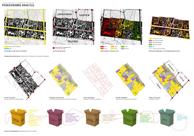
The street is an essential thing in connecting urban spaces, bringing people and urban elements together. From the analysis conducted along and around the street and alleyways of Jalan Jenderal Sudirman, one of the most important considerations for the design intervention is to create robust connections between people and buildings that face each other. The design strategy calls for a continuous qualities of street path, blocks and infrastructure, which combined them into an armature – an element that connect and hold the city fabric together. In the case of this intervention, anchors will be placed at strategic locations, creating interesting destination and points for visitors to approach them through the existing small streets and alleys. This theory of armature was developed by Victor Gruen, the Austrian-born architect best known for his commercial and shopping mall designs in the United States. The labyrinth-like streets of the area, which penetrates from the main street of Jalan Jenderal Sudirman into the settlement areas behind it, provide a good context to implement this idea of connection and networks.
The street, a social element in the city may also function as meeting places that can encourage human contact. However, in the case of this study’s site, the street seems to be under-utilized, only functioning as access route for those living there. The potential of the site, which include its strong character as one of the most important area for Bandung may change this condition as long as correct and precise actions were to be implemented. Learning from the critic of Jane Jacobs in her book, ‘The Death and Life of Great American Cities: The Failure of Town Planing’ (1965. p.39), this proposal try to improve the quality of life of the street by re-integrating separated elements (housing, commercial, public spaces, leisure) into a continuous networks of programs. The first step to be taken is to give fresh branding idea to the area. From its contextual character, a new kampung kota image as a place making strategy is needed in creating and enhancing new synergy between existing dwellings and home industries. This re-branding concept, which will be known as Kampung Kriya Sudirman will provide better opportunities for home industries, that is soon hoped to create a positive domino effect towards the development of other industries such as tourism and creative markets for local products of the home industry of the place.
To support the idea of Kampung Kriya Sudirman, series of smaller interventions should be placed at strategic points around the site. These series of interventions are urban components and details that are hoped to make the place distinctive and help define its character of place. A rich and rewarding city experience is very important to enhance the quality of place, and creating ‘life between buildings’ is an important measure to achieve this. The seminal text, ‘Life Between Buildings’ by Jan Gehl (1987) is an important reference in developing the idea of placing these interventions. New spatial typologies will be created, and these elements will also function as supporting components for the place re-branding approach.


